Arcanepotato@crazypeople.onlinetoNews@lemmy.world•America's largest grid wants to cut power to new data centers first during shortages — 50MW-plus data centers must bring their own electricity generation to avoid shutoffsEnglish
9·
2 days agoA bit of a guess but I think this is the data centre in the picture: https://maps.app.goo.gl/8MGY8u3cfdPEGDyC8?g_st=ac
Here it is in a zoning map with the data centre circled:
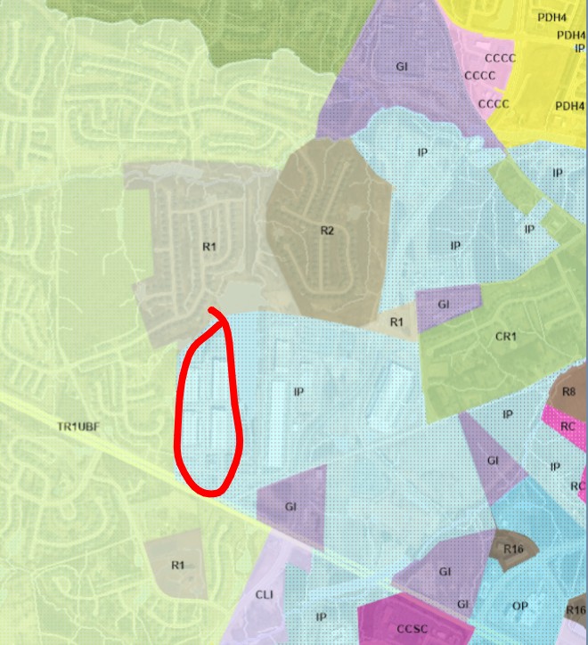
IP is zoning for an industrial park and GI is “General Industry: District for industrial uses that are incompatible with residential uses due to the prevalence of outdoor storage and emissions of noise and odor.”
Sure, zoning changes but given the distribution and proximity to the airport and quarries it seems unlikely it’s all amendments. This very weary engineer is literally begging people to read zoning maps and flood plain maps before buying a house.
deleted by creator